


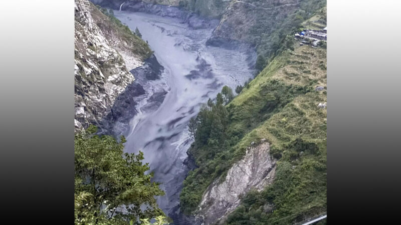
KATHMANDU – Ground displacement of up to 40 centimetres was recorded on the northern slope of Langtang Lirung before the devastating flood in the Rasuwa-Kerung area on August 26, according to a new study.
The International Centre for Integrated Mountain Development (ICIMOD) released the preliminary scientific study on Tuesday. Radar data from the Sentinel-1 satellite over a 48-day period, from July 7 to August 24, 2026, showed surface displacement of up to 40 centimetres in the area.
ICIMOD Director General Pema Gyamtsho presented the study, titled “Understanding the August 26, 2026 Kerung-Rasuwa Disaster,” at the Fifth National Conference on Disaster Risk Reduction.
According to the study, an estimated 132 million cubic metres of rock and glacier ice fell from the northern slope of Langtang Lirung into the Lende Khola valley. This created a fast-moving flow of rock, ice, water and debris that caused destruction in the Nepal-China border area.
The study identified the event not as a conventional glacial lake outburst flood (GLOF) but as a cascading disaster triggered by the fall of rock and glacier ice.
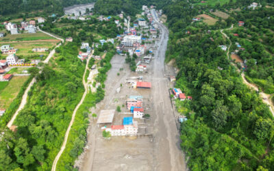
According to the National Disaster Risk Reduction and Management Authority, at least 1,451 people died on the Nepal side, and 5,745 are missing. Officials on the China side had reported 43 deaths and 519 missing.
The study combined satellite data, seismic records, drone surveys, hydrological analysis and field assessments to analyse the causes and effects of the disaster and the state of early warning systems.
The study states that although satellites can detect displacement on mountain surfaces, they cannot predict exactly when a landslide or rockfall will occur. Scientists say, however, that such technologies can help identify hazardous slopes for further monitoring.
“This event has shown that measurable surface changes can appear on some hazardous mountain slopes before a catastrophic event,” Gyamtsho said. “The challenge now is to turn scientific information into practical risk reduction through effective monitoring and regional cooperation.”
According to the study, the rock and ice fall at Langtang Lirung occurred at 8:37 am Nepal time. The debris-laden flood reached the border area in about seven minutes. An early warning was sent by mobile message at around 9:15 to 9:16 am, about 25 to 30 minutes after the border area had been affected.
The study noted that existing early warning systems, based on rainfall and river water levels, cannot identify the risk of sudden mountain rockfalls and glacier collapses. It recommends integrating satellite monitoring, seismic observation, hydrological data, impact-based forecasting and cross-border information sharing.
Possible causes of the rockfall listed in the study include geological weakness, damage from the 2015 earthquake, thawing of permafrost (frozen ground), changes in the glacier, and the gradual accumulation of snow and ice. However, no single definitive cause has been confirmed.
Separately, in July 2025, a flood occurred when water drained from a lake that had formed on a glacier surface in the Peripu area. In August 2026, rock and ice fell from Langtang Lirung, causing another devastating disaster in the same border corridor. The two events show that the region faced two major cross-border disasters of different kinds within 13 months.
The study also states that satellite images confirmed a separate rock and glacier fall in the Budhi Gandaki basin. Further study is under way on the sequence of events, their impact and the measures needed to reduce future risk.
Changgong Zhang, head of climate and environmental risk at ICIMOD, said satellite data and scientific methods can help not only in understanding past disasters but also in identifying areas that may become hazardous in the future.
A joint team from ICIMOD and a partner institution in China will begin fieldwork this week to collect further evidence in the affected area. The study is expected to help identify hazardous areas, improve monitoring and strengthen early warning systems in the Hindu Kush Himalaya region.





Comments
Share your opinion or feedback. Please keep comments respectful and constructive.